Analyze a topographical map to choose a water source for multi-year tracking of chemical analysis
Science Domains: Earth & Space Sciences, Life Science
NGSS Standards: ESS2.C, ETS1.A-C, ETS1.B-C, LS2.A, LS2.C, LS4.D, PS1.A, PS1.B, PS3.D
Project
Analyze a topographical map to choose a water source for multi-year tracking of chemical analysis
Science Domains: Earth & Space Sciences, Life Science
NGSS Standards: ESS2.C, ETS1.A-C, ETS1.B-C, LS2.A, LS2.C, LS4.D, PS1.A, PS1.B, PS3.D
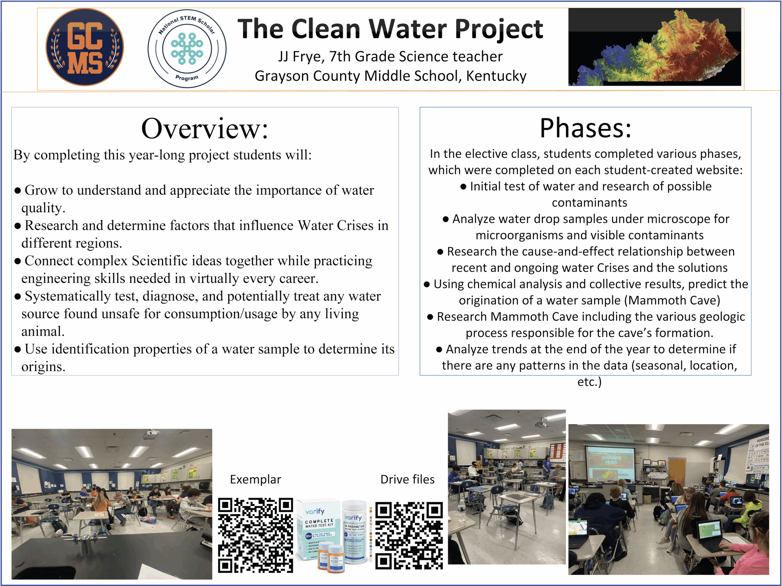
Download the project poster as a PDF. The project poster includes a description of the challenge, learning goals, and a list of materials and references.
Download The Poster (PDF)Students will advance foundational skills and develop connections through collecting and analyzing data. Students will develop arguments to determine safety of their water samples. Students will hold conversations with professionals about jobs in the community (mainly employees working at water treatment plants) and explore careers in STEM often overlooked but vital to society. Students will collect meaningful and individualized data and talk about photosynthesis/respiration, chemical reactions, traits and reproduction, energy transfer, light and sound waves, electricity and magnetism.